Hopland | |
|---|---|
 Downtown Hopland | |
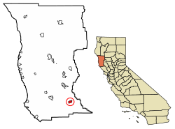
 Location in Mendocino County and California | |
| Coordinates: 38°58′23″N 123°06′59″W / 38.97306°N 123.11639°W | |
| Country | |
| State | |
| County | Mendocino |
| Area | |
| • Total | 3.573 sq mi (9.25 km2) |
| • Land | 3.525 sq mi (9.13 km2) |
| • Water | 0.048 sq mi (0.12 km2) 1.35% |
| Elevation | 502 ft (153 m) |
| Population (2020)[3] | |
| • Total | 661 |
| • Density | 180/sq mi (71/km2) |
| Time zone | UTC-8 (Pacific) |
| • Summer (DST) | UTC-7 (PDT) |
| ZIP code | 95449 |
| Area code | 707 |
| FIPS code | 06-34652 |
| GNIS feature IDs | 1658778;[2] 2628739[4] |
Hopland (formerly Sanel)[5] is a census-designated place[4] in Mendocino County, California, United States.[2] It is located on the west bank of the Russian River, 13 miles (21 km) south-southeast of Ukiah,[5] in the Sanel Valley, at an elevation of 502 feet (153 m).[2] The population was 661 at the 2020 census,[3] down from 756 at the 2010 census.
Hopland is located at the start of the North Coast or Redwood Coast region of Northern California. It is 100 miles (161 km) north of San Francisco along U.S. Route 101 and a 30-minute drive (17 miles [27 km] east along State Route 175) to California's largest natural lake, Clear Lake. Hopland is a rustic farming community situated among oak-covered coastal foothills. Summer temperatures can exceed 100 °F (38 °C).
Historic buildings in town include the old Hopland High School (c. 1923–1965),[6] as well as the Thatcher Hotel, built in the late 1800s and recently reopened[when?] after undergoing a complete renovation.
Approximately 5 mi (8 km) east of Hopland is the University of California's Hopland Research and Extension Center (formerly called the "Hopland Field Station"), a 5,300-acre (21.4 km2) research and education facility that UC has operated since 1951.
- ^ "2021 U.S. Gazetteer Files: California". United States Census Bureau. Retrieved August 2, 2022.
- ^ a b c d U.S. Geological Survey Geographic Names Information System: Hopland, California
- ^ a b "P1. Race – Hopland CDP, California: 2020 DEC Redistricting Data (PL 94-171)". U.S. Census Bureau. Retrieved August 2, 2022.
- ^ a b U.S. Geological Survey Geographic Names Information System: Hopland, California
- ^ a b Durham, David L. (1998). California's Geographic Names: A Gazetteer of Historic and Modern Names of the State. Clovis, Calif.: Word Dancer Press. p. 79. ISBN 1-884995-14-4.
- ^ "Healdsburg Tribune, Enterprise and Scimitar 13 May 1965 — California Digital Newspaper Collection". cdnc.ucr.edu. Retrieved September 9, 2019.

