| Horning | |
|---|---|
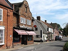
 Post Office and shop fronts on Lower Street | |
Location within Norfolk | |
| Area | 11.04 km2 (4.26 sq mi) |
| Population | 1,100 (approx, 2021)[1] |
| • Density | 100/km2 (260/sq mi) |
| OS grid reference | TG343170 |
| Civil parish |
|
| District | |
| Shire county | |
| Region | |
| Country | England |
| Sovereign state | United Kingdom |
| Post town | NORWICH |
| Postcode district | NR12 |
| Dialling code | 01692 |
| Police | Norfolk |
| Fire | Norfolk |
| Ambulance | East of England |
| UK Parliament | |
Horning is an ancient village and parish in the English county of Norfolk. It covers an area of 11 km2 and had a population of approximately 1,100 in the 2021 census.[2] Horning parish lies on the northern bank of the River Bure south of the River Thurne and is located in The Broads National Park. For the purposes of local government, it falls within the district of North Norfolk, although areas alongside the rivers and broads fall into the executive area of the Broads Authority.
- ^ "Build a custom area profile". Census 2021, ONS. Retrieved 11 August 2024.
- ^ "Build a custom area profile". Census 2021, ONS. Retrieved 11 August 2024.
