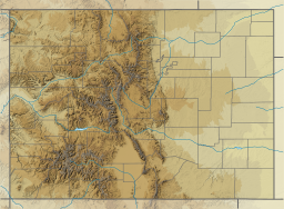
| Horsetooth Reservoir | |
|---|---|
 | |
| Location | Larimer County, Colorado |
| Coordinates | 40°33′16″N 105°09′21″W / 40.55436°N 105.15591°W |
| Type | reservoir |
| Basin countries | United States |
| Max. depth | 200 ft (61 m) |
| Water volume | 156,735 acre⋅ft (0.193330 km3) |
| Surface elevation | 5,430 ft (1,660 m) |

Horsetooth Reservoir (often known locally as Horsetooth) is a large reservoir in southern Larimer County, Colorado, in the foothills just west of the city of Fort Collins, Colorado. The reservoir runs north-south for approximately 6.5 miles (10 km) and is approximately one-half mile (1 km) wide. Its shape and orientation are the result of the fact that the main body of the reservoir is contained between several homoclinal ridges. A ridge composed of Dakota sandstone runs along the east side where gaps in the ridge are plugged by dams. On the west (uphill) side there are two prominent ridges topped by erosion-resistant sandstones of the Lyons and Ingleside formations.[1] Gaps in these ridges have created a handful of bays and coves the largest of which is Inlet Bay, home to a marina and campgrounds.
The reservoir was constructed in 1949 by the Bureau of Reclamation as part of its federal Colorado-Big Thompson Project or "C-BT". Water distribution is currently managed by Reclamation and operated by the Northern Colorado Water Conservancy District. Horsetooth and Carter Lake serve as the two principal reservoirs for water diverted eastward under the continental divide via the C-BT.
The reservoir is a supplementary source of municipal water for Fort Collins, Greeley and other communities in the region, as well as for irrigation in the lower South Platte River basin. The reservoir takes its name from Horsetooth Mountain, a summit in the foothills west of the southern end of the reservoir.
- ^ Braddock, William; Calvert, Ronald; O’Connor, Joseph; Swann, Gordon (1989). Geologic Map of the Horsetooth Reservoir Quagrangle, Larimer County, Colorado (Map). 1:24,000. United States Geological Survey. GQ-1625.

