Huachipato | |
|---|---|
district (neighbourhood) | |
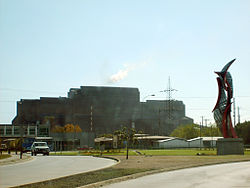
 Main entrance to Siderúrgica Huachipato | |
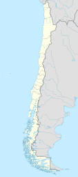
| Coordinates (city): 36°44′53″S 073°05′55″W / 36.74806°S 73.09861°W[1] | |
| Country | Chile |
| Region | Biobío |
| Province | Concepción |
| Commune | Talcahuano |
| Area | |
| • Total | 13.2 km2 (5.1 sq mi) |
| Elevation | 1 m (3 ft) |
| Population (2002 Census)[2] | |
| • Total | 9,665 |
| • Density | 730/km2 (1,900/sq mi) |
| Time zone | UTC−4 (CLT) |
| • Summer (DST) | UTC−3 (CLST) |
| Area code | 56 + 41 |
Huachipato is census district and neighbourhood in Talcahuano Commune, part of the conurbation of Greater Concepción in the Biobío Region of southern Chile.[1] It is the industrialized part of the commune supporting a steel mill and oil refinery.[3]
- ^ a b Huachipato (Approved - N) at GEOnet Names Server, United States National Geospatial-Intelligence Agency
- ^ a b "División Político Administrativa y Censal" (PDF) (in Spanish). Instituto Nacional de Estadísticas (INE). 2007. p. 177. Archived from the original (PDF) on 8 March 2013.
- ^ "Hitos: Polo Industrial ENAP-HUACHIPATO" (in Spanish). Talcahuano. Archived from the original on 24 September 2015.
