Huberdeau | |
|---|---|
 | |
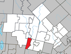
 Location within Les Laurentides RCM | |
| Coordinates: 45°58′N 74°38′W / 45.967°N 74.633°W[1] | |
| Country | |
| Province | |
| Region | Laurentides |
| RCM | Les Laurentides |
| Constituted | June 8, 1926 |
| Named for | Gédéon-Ubalde Huberdeau[1] |
| Government | |
| • Mayor | Benoit Chevalier |
| • Federal riding | Laurentides—Labelle |
| • Prov. riding | Labelle |
| Area | |
| • Total | 59.50 km2 (22.97 sq mi) |
| • Land | 56.72 km2 (21.90 sq mi) |
| Population (2021)[3] | |
| • Total | 863 |
| • Density | 15.2/km2 (39/sq mi) |
| • Pop 2016-2021 | |
| • Dwellings | 527 |
| Time zone | UTC−5 (EST) |
| • Summer (DST) | UTC−4 (EDT) |
| Postal code(s) | |
| Area code | 819 |
| Highways | |
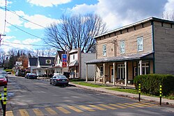
Huberdeau (French pronunciation: [ybɛʁdo]) is a village and municipality in the Laurentides region of Quebec, Canada, part of the Les Laurentides Regional County Municipality. It is located along the western banks of the Rouge River.
