Hudson County | |
|---|---|
 View north on Hudson Waterfront | |
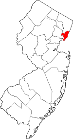
 Location within the U.S. state of New Jersey | |
 New Jersey's location within the U.S. | |
| Coordinates: 40°44′N 74°05′W / 40.73°N 74.08°W | |
| Country | |
| State | |
| Founded | 1840 |
| Named for | Henry Hudson |
| Seat | Jersey City[1] |
| Largest city | Jersey City (population and area) |
| Government | |
| • County executive | Craig Guy (D, term ends December 31, 2027) |
| Area | |
• Total | 62.35 sq mi (161.5 km2) |
| • Land | 46.19 sq mi (119.6 km2) |
| • Water | 16.15 sq mi (41.8 km2) 25.9% |
| Population | |
• Total | 724,854 |
| 705,472 | |
| • Density | 12,000/sq mi (4,500/km2) |
| Congressional districts | 8th, 9th, 10th |
| Website | www |
Hudson County is the smallest and most densely populated county in the U.S. state of New Jersey. It lies west of the lower Hudson River, which was named for Henry Hudson, the sea captain who explored the area in 1609.[5] Part of New Jersey's Gateway Region in the New York metropolitan area, the county seat is Jersey City,[1] which is the county's largest city in terms of both population and area. The county is part of the North Jersey region of the state.[6]
As of the 2020 United States census, the county was the state's fourth-most-populous and fastest-growing county in the previous decade,[7] with a population of 724,854,[3][8] its highest decennial count ever and an increase of 90,588 (+14.3%) from the 2010 census count of 634,266,[9] which in turn reflected an increase of 25,291 (+4.2%) from the 2000 census population of 608,975.[10][11]
Home to 15,693 residents per square mile (6,130/km2) in 2020 and covering 46.19 square miles (119.6 km2) of land, Hudson County is New Jersey's geographically smallest and most densely populated county.[9] Hudson County shares extensive mass transit connections with Manhattan, located across the Hudson River, as well as with most of Northern and Central New Jersey.
- ^ a b New Jersey County Map, New Jersey Department of State. Accessed February 27, 2023.
- ^ Cite error: The named reference
CensusAreawas invoked but never defined (see the help page). - ^ a b c Cite error: The named reference
Census2020was invoked but never defined (see the help page). - ^ Cite error: The named reference
PopEstwas invoked but never defined (see the help page). - ^ Kane, Joseph Nathan; and Aiken, Charles Curry. The American Counties: Origins of County Names, Dates of Creation, and Population Data, 1950-2000, p. 140. Scarecrow Press, 2005. ISBN 0810850362. Accessed January 21, 2013.
- ^ Willis, David P. "'This is how wars start': Does Central Jersey include both Ocean and Union counties?", Asbury Park Press, February 20, 2023. Accessed March 31, 2024. "North Jersey is defined as Sussex, Warren, Morris, Passaic, Bergen, Essex and Hudson counties; South Jersey would be Burlington, Camden, Gloucester, Atlantic, Salem, Cumberland and Cape May counties. But for Central, things get a little tricky. It would include Hunterdon, Somerset, Union, Middlesex, Mercer, Monmouth, and Ocean counties."
- ^ Table 1. New Jersey Counties and Most Populous Cities and Townships: 2020 and 2010 Censuses, New Jersey Department of Labor and Workforce Development. Accessed December 1, 2022.
- ^ Cite error: The named reference
LWD2020was invoked but never defined (see the help page). - ^ a b DP1 - Profile of General Population and Housing Characteristics: 2010 Demographic Profile Data for Hudson County, New Jersey, United States Census Bureau. Accessed January 21, 2013.
- ^ Cite error: The named reference
Census2000was invoked but never defined (see the help page). - ^ Wu, Sen-Yuan. NJ Labor Market Views; Population Keeps Growing in the Most Densely Populated State, United States Census Bureau, March 15, 2011. Accessed December 26, 2022.

