Hughes County | |
|---|---|
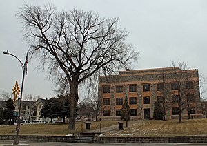
 Hughes County Courthouse in Pierre | |
 Location within the U.S. state of South Dakota | |
 South Dakota's location within the U.S. | |
| Coordinates: 44°23′N 99°59′W / 44.39°N 99.99°W | |
| Country | |
| State | |
| Founded | January 8, 1873 (created) November 26, 1880 (organized) |
| Named for | Alexander Hughes |
| Seat | Pierre |
| Largest city | Pierre |
| Area | |
• Total | 801 sq mi (2,070 km2) |
| • Land | 742 sq mi (1,920 km2) |
| • Water | 59 sq mi (150 km2) 7.4% |
| Population (2020) | |
• Total | 17,765 |
• Estimate (2023) | 17,624 |
| • Density | 22/sq mi (8.6/km2) |
| Time zone | UTC−6 (Central) |
| • Summer (DST) | UTC−5 (CDT) |
| Congressional district | At-large |
| Website | www |
Hughes County is a county in the U.S. state of South Dakota. As of the 2020 census, the population was 17,765, making it the least populous capital county in the nation, and the 12th most populous county in South Dakota.[1] Its county seat is Pierre,[2] which is also the state capital. The county was created in 1873, and was organized in 1880. It was named for Alexander Hughes, a legislator.[3] On June 4, 1891, the county's area was increased by the addition of Farm Island, in the Missouri River downstream of Pierre.[4]
Hughes County is part of the Pierre, SD Micropolitan Statistical Area.
- ^ "State & County QuickFacts". United States Census Bureau. Retrieved March 21, 2024.
- ^ "Find a County". National Association of Counties. Archived from the original on May 31, 2011. Retrieved June 7, 2011.
- ^ Gannett, Henry (1905). The Origin of Certain Place Names in the United States. Govt. Print. Off. p. 162.
- ^ "Dakota Territory, South Dakota, and North Dakota: Individual County Chronologies". Dakota Territory Atlas of Historical County Boundaries. The Newberry Library. 2006. Archived from the original on April 2, 2018. Retrieved March 29, 2015.