| Gilbert South Australia | |||||||||||||||
|---|---|---|---|---|---|---|---|---|---|---|---|---|---|---|---|
 Giles Corner, south of Riverton | |||||||||||||||
| Coordinates | 34°12′S 138°47′E / 34.20°S 138.79°E | ||||||||||||||
| Established | 7 August 1851 | ||||||||||||||
| Area | 291 km2 (112.5 sq mi) | ||||||||||||||
| County | Light | ||||||||||||||
| |||||||||||||||
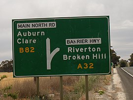
The Hundred of Gilbert is a cadastral unit of hundred in the northern Mount Lofty Ranges including the town of Riverton.[1] It is one of the nine hundreds of the County of Light.[2] It was proclaimed in 1851 by Governor Henry Young and named after the Gilbert River, which flows from north to south through the hundred.[1] The river, in turn, was named in honour of South Australian pioneer Thomas Gilbert.
Riverton, Marrabel (west half), Rhynie (part east of Horrocks Highway), Giles Corner (part) and Tarlee of the Clare and Gilbert Valleys council are situated inside (or largely inside) the bounds of the Hundred of Gilbert, as well as Hamilton (west of Marrabel Road) of the Light Regional Council.
- ^ a b "Search result for 'Hundred of Riverton, HD'". Property Location Browser. Government of South Australia. SA0026019). Archived from the original on 7 December 2015. Retrieved 21 June 2017.
Derivation of Name: Gilbert River
- ^ South Australia hundred maps 1:63 360. Surveyor General's Office. 1867.
