Hurden | |
|---|---|
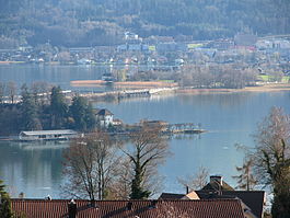
 Seedamm and Hurden, as seen from Frohberg hill in Kempraten-Lenggis, the Capuchin monastery in Rapperswil to the left, Pfäffikon in the background | |
| Coordinates: 47°11.6′N 8°46.6′E / 47.1933°N 8.7767°E | |
| Country | Switzerland |
| Canton | Schwyz |
| District | Höfe |
| Municipality | Freienbach |
| Area | |
• Total | 1.31 km2 (0.51 sq mi) |
| Elevation | 408 m (1,339 ft) |
| Population (2008) | |
• Total | 268 |
| • Density | 200/km2 (530/sq mi) |
| Time zone | UTC+01:00 (Central European Time) |
| • Summer (DST) | UTC+02:00 (Central European Summer Time) |
| Postal code(s) | 8640 |
| SFOS number | 1322 |
| ISO 3166 code | CH-SZ |
| Surrounded by | Altendorf, Switzerland, Pfäffikon, Rapperswil |
| Website | www SFSO statistics |
Hurden is a village in the municipality of Freienbach in the canton of Schwyz in Switzerland. First mentioned in 1217, the name "de Hurden" was used for the peninsula and for the fish traps made of woven work, called "Hürden" or "Hurden", which were used by the locals.


