Hyder, Alaska | |
|---|---|
 The border between Stewart, British Columbia, and Hyder, as seen from the Canadian side. | |
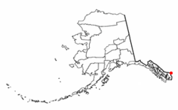
 Location of Hyder, Alaska. | |
| Coordinates: 55°54′51″N 130°01′28″W / 55.91417°N 130.02444°W | |
| Country | United States |
| State | Alaska |
| Census area | Prince of Wales–Hyder |
| Government | |
| • State senator | Bert Stedman (R) |
| • State rep. | Dan Ortiz (I) |
| Area | |
| • Total | 17.07 sq mi (44.21 km2) |
| • Land | 17.07 sq mi (44.21 km2) |
| • Water | 0.00 sq mi (0.00 km2) |
| Elevation | 118 ft (36 m) |
| Population (2020) | |
| • Total | 48 |
| • Density | 2.81/sq mi (1.09/km2) |
| Time zone | Official time: Alaska (AKST)[2] Unofficial time: PST[3] |
| • Summer (DST) | Official time: AKDT[2] Unofficial time: PDT[3] |
| ZIP Code | 99923 |
| Area code(s) | 236, 250, 672, 778 |
| FIPS code | 02-34570 |
| GNIS feature ID | 1422711 |
Hyder is a census-designated place in Prince of Wales–Hyder Census Area, Alaska, United States. The population was 48 at the 2020 census, down from 87 in 2010.[5] Hyder is accessible by road only from Stewart, British Columbia. It is popular with motorists wishing to visit Alaska without driving the length of the Alaska Highway. Hyder has no direct access to any Alaskan road. It is the southernmost community in the state that can be reached via car (others can be reached only by boat or plane). Hyder is Alaska's easternmost community.[4][6]
- ^ "2020 U.S. Gazetteer Files". United States Census Bureau. Retrieved October 29, 2021.
- ^ a b Cite error: The named reference
TTHYDERwas invoked but never defined (see the help page). - ^ a b Cite error: The named reference
TTSTEWARTwas invoked but never defined (see the help page). - ^ a b Cite error: The named reference
GSPP1967was invoked but never defined (see the help page). - ^ Cite error: The named reference
ADCRAwas invoked but never defined (see the help page). - ^ "Folks living in this tiny outpost on the Alaskan border may use Canadian dollars, but they're still '100% American'". National Post. September 11, 2013. Retrieved August 12, 2017.