| IJsselmeer | |
|---|---|
 Sentinel-2 photo of the Wadden Sea (top), IJsselmeer (middle), and Markermeer (bottom) | |
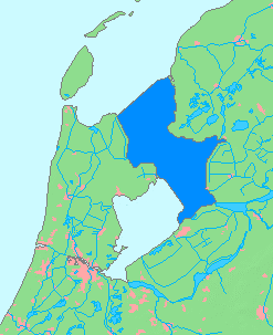
 IJsselmeer in dark blue | |
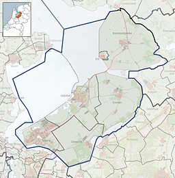
| Location | Netherlands |
| Coordinates | 52°49′N 5°15′E / 52.817°N 5.250°E |
| Primary inflows | IJssel, Overijsselse Vecht |
| Primary outflows | Wadden Sea (which empties into the North Sea) |
| Surface area | 1,100 km2 (420 sq mi) |
| Average depth | 4.5 m (15 ft) |
| Max. depth | 9 m (30 ft) |
| Surface elevation | −0.4 m (−1.3 ft) (winter) −0.2 m (−0.66 ft) (summer) [1] |
| Designated | 29 August 2000 |
| Reference no. | 1246[2] |

The IJsselmeer[a] (Dutch: [ˌɛisəlˈmeːr] ; West Frisian: Iselmar, Dutch Low Saxon: Iesselmeer), also known as Lake IJssel in English,[3] is a closed-off freshwater lake in the central Netherlands bordering the provinces of Flevoland, North Holland and Friesland. It covers an area of 1,100 km2 (420 sq mi) with an average depth of 4.5 m (15 ft).[1] The river IJssel, after which the lake was named, flows into the IJsselmeer.
- ^ a b "IJsselmeer". Natura 2000 (in Dutch). Dutch Ministry of Agriculture, Nature and Food Quality. Retrieved 24 June 2023.
- ^ "IJsselmeer". Ramsar Sites Information Service. Retrieved 25 April 2018.
- ^ "IJsselmeer". Merriam-Webster.com Dictionary. Merriam-Webster. Retrieved 1 May 2019.
Cite error: There are <ref group=lower-alpha> tags or {{efn}} templates on this page, but the references will not show without a {{reflist|group=lower-alpha}} template or {{notelist}} template (see the help page).
