Ida[1]
Uí Dheá (Irish) Barony of Ida | |
|---|---|
Map of Ida | |
![Ida[1] is located in Ireland](http://upload.wikimedia.org/wikipedia/commons/thumb/c/c9/Ireland_adm_location_map.svg/250px-Ireland_adm_location_map.svg.png) Ida[1] Location in Ireland | |
| Coordinates: 52°22′50″N 7°2′16″W / 52.38056°N 7.03778°W | |
| Country | Ireland |
| Province | Leinster |
| County | County Kilkenny |
| Civil parishes | List
|
| Government | |
| • Type | County Council |
| • Body | Kilkenny County Council |
| Area | |
| • Total | 249.8 km2 (96.4 sq mi) |
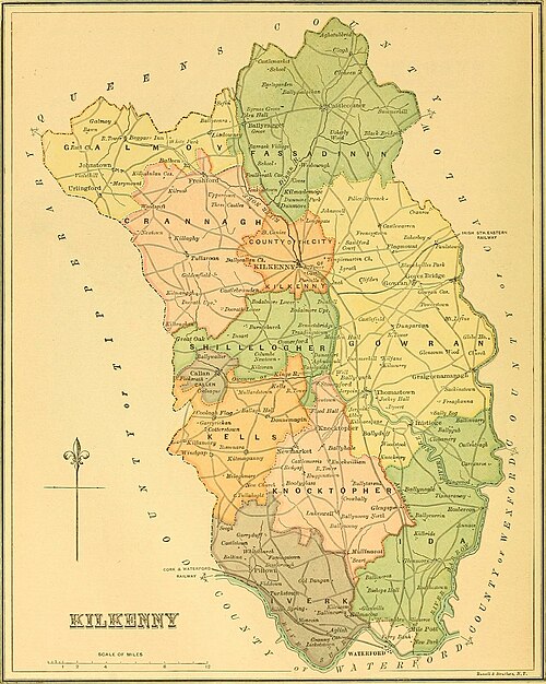
Ida (Irish: Uí Dheá[3][4]) is a barony in the south-east of County Kilkenny, Ireland.[1][5] Ida is made up of 16 civil parishes containing 191 townlands, it is one of 12 baronies in the County.[3][6] The barony is 249.8 square kilometres (96.4 sq mi) in size, with highest point at Tory Hill.[7] The chief town is Slieveroe.[8] The N25 crosses the barony.
Ida lies at the south-east of the county, with the barony of Gowran to the north (whose chief town is Gowran), Iverk and Knocktopher to the west (whose chief towns are Piltown and Knocktopher), and the barony of Kilculliheen to the south. County Waterford is located to the east of the barony.
- ^ a b Cite error: The named reference
Government2003was invoked but never defined (see the help page). - ^ Cite error: The named reference
Parliamentwas invoked but never defined (see the help page). - ^ a b Cite error: The named reference
logainmIdawas invoked but never defined (see the help page). - ^ Cite error: The named reference
Carrigan1905was invoked but never defined (see the help page). - ^ Cite error: The named reference
Tighe1802was invoked but never defined (see the help page). - ^ Cite error: The named reference
logainmIdaParisheswas invoked but never defined (see the help page). - ^ Cite error: The named reference
townlands.iewas invoked but never defined (see the help page). - ^ Cite error: The named reference
logainmSlieveroewas invoked but never defined (see the help page).
