This article has an unclear citation style. (October 2021) |
Idaho Falls Regional Airport Fanning Field | |||||||||||||||
|---|---|---|---|---|---|---|---|---|---|---|---|---|---|---|---|
 | |||||||||||||||
| Summary | |||||||||||||||
| Airport type | Public | ||||||||||||||
| Owner/Operator | City of Idaho Falls | ||||||||||||||
| Serves | Idaho Falls, Idaho | ||||||||||||||
| Location | 2140 N. Skyline Dr. | ||||||||||||||
| Elevation AMSL | 4,744 ft / 1,446 m | ||||||||||||||
| Coordinates | 43°30′49″N 112°04′15″W / 43.51361°N 112.07083°W | ||||||||||||||
| Website | Official website | ||||||||||||||
| Maps | |||||||||||||||
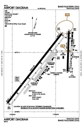
 FAA airport diagram as of January 2021 | |||||||||||||||
 | |||||||||||||||
| Runways | |||||||||||||||
| |||||||||||||||
| Statistics (2016) | |||||||||||||||
| |||||||||||||||
Idaho Falls Airport Historic District | |||||||||||||||
 The 1936 hangar in 2023 | |||||||||||||||
| Location | 2381 Foote Dr., Idaho Falls, Idaho | ||||||||||||||
| Coordinates | 43°31′02″N 112°03′30″W / 43.51722°N 112.05833°W | ||||||||||||||
| Area | 4 acres (1.6 ha) | ||||||||||||||
| Built | 1930 | ||||||||||||||
| Architect | C.R. Black | ||||||||||||||
| Architectural style | Rustic | ||||||||||||||
| NRHP reference No. | 97001126[2] | ||||||||||||||
| Added to NRHP | September 10, 1997 | ||||||||||||||
Idaho Falls Regional Airport (IATA: IDA, ICAO: KIDA, FAA LID: IDA) is two miles north-northwest of downtown Idaho Falls, Idaho, United States.[1] It is locally known as Fanning Field.[3] It is the second-busiest airport in Idaho after Boise Airport.
The National Plan of Integrated Airport Systems for 2011–2015 categorized it as a primary commercial service facility. Federal Aviation Administration records say the airport had 148,584 passenger boardings (enplanements) in calendar year 2008, 138,957 in 2009 and 144,365 in 2010.
- ^ a b FAA Airport Form 5010 for IDA PDF. Federal Aviation Administration. Effective November 30, 2023.
- ^ "National Register Information System". National Register of Historic Places. National Park Service. November 2, 2013.
- ^ "Idaho Falls-Fanning Field". Aviation Safety Network. Retrieved July 11, 2013.

