This article needs additional citations for verification. (March 2015) |
Ikoyi | |
|---|---|
Neighborhood | |
 Ikoyi with Lekki in the background | |
| Coordinates: 6°27′N 3°26′E / 6.450°N 3.433°E | |
| Country | Nigeria |
| State | Lagos State |
| City | Lagos |
| LGA | Eti-Osa |
| Time zone | UTC+1 (WAT) |
| Climate | Aw |
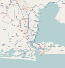
Ikoyi is the most affluent neighborhood of Lagos, located in Eti-Osa Local Government Area.[1][2] It lies to the northeast of Obalende and adjoins Lagos Island to the west, and at the edge of the Lagos Lagoon. Popular with the extreme upper class residents of Nigerian society, Ikoyi is arguably one of the wealthiest communities within Nigeria.


The area that makes up Ikoyi was originally a continuous land mass with Lagos Island, until it was separated from it by the MacGregor canal, a narrow waterway that was dug by the British colonial government. This canal has now been built over or filled in, so that the island is fused with Lagos Island once again. It has been called in derogatory terms the "Beverly Hills by the slum" or the Belgravia of Lagos.
The area is often referred to as Ikoyi I and Ikoyi II. Ikoyi I is the area is typically closer to the original, older part of Ikoyi, which includes some of the most historic and well-established neighborhoods. Ikoyi I often features more traditional architecture and older buildings, though many have been renovated or repurposed for modern use. This part of Ikoyi might house some of the well-known landmarks and historic sites, like the Ikoyi Club and some of the older colonial-era structure. Ikoyi II generally refers to the newer developments and extensions of the original Ikoyi, sometimes encompassing areas that have seen significant recent growth. Ikoyi II is often characterized by more contemporary developments, high-rise luxury apartments, and new commercial properties. This section might include new shopping complexes, office buildings, and modern infrastructure developments. The primary differences between Ikoyi I and Ikoyi II lie in their location within Ikoyi, the age and style of development, and the type of landmarks or facilities present in each area.
- ^ Google Maps (Map). Google.
- ^ Bing Maps (Map). Microsoft and Harris Corporation Earthstar Geographics LLC.
