Iksal
| |
|---|---|
| Hebrew transcription(s) | |
| • ISO 259 | ʔikksal, Ksalot Tabor |
 Iksal, as seen from Nazareth Illit | |
| Coordinates: 32°41′N 35°19′E / 32.683°N 35.317°E | |
| Grid position | 180/232 PAL |
| Country | |
| District | Northern |
| Area | |
• Total | 9,000 dunams (9 km2 or 3 sq mi) |
| Population (2022)[1] | |
• Total | 15,336 |
| • Density | 1,700/km2 (4,400/sq mi) |
| Name meaning | from ancient Chesulloth, probably after a personal name[2] |
| Website | موقع إكسال مدرسة إكسال الثانوية مدرسة إكسال الإعداديةالرازي |
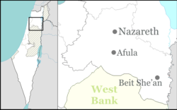
Iksal (Arabic: إكسال, Hebrew: אִכְּסָאל, כִּסְלוֹת תָּבוֹר, Kislot Tavor[3]) is an Arab local council in northern Israel, about 5 kilometres (3.1 mi) southeast of Nazareth.[4] It has an area of 9,000 dunams and a population of 15,336 primarily Muslim inhabitants. [1]
- ^ a b "Regional Statistics". Israel Central Bureau of Statistics. Retrieved 21 March 2024.
- ^ Palmer, 1881, p. 126
- ^ HaReuveni, Immanuel (1999). Lexicon of the Land of Israel (in Hebrew). Miskal - Yedioth Ahronoth Books and Chemed Books. p. 37. ISBN 965-448-413-7.
- ^ Cite error: The named reference
Freedmanp236was invoked but never defined (see the help page).


