Ilha do Cabo
Ilha de Luanda | |
|---|---|
 | |
| Coordinates: 8°46′43″S 13°14′37″E / 8.77861°S 13.24361°E | |
| Location | Luanda Province, Angola |

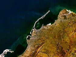
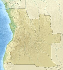
Ilha do Cabo (English: Cape Island) typically known as Ilha de Luanda (English: Island of Luanda) is a spit[1] off the shore of Luanda, the capital of Angola, a country on the continents' southwestern coast. It consists of a low sandy strip formed by sedimentation. In administrative terms, the peninsula belongs to the municipality of Ingombota in the Luanda Province.
- ^ "Map of Luanda". Archived from the original on 2013-04-19. Retrieved 2013-03-01.
