Ilhabela | |
|---|---|
| Municipality of Ilhabela | |
| Nickname(s): Ilhabela, Capital da Vela (Ilhabela, Capital of Sailing) | |
| Motto: Ilhabela da Princesa | |
 Location in the state of São Paulo and in Brazil | |
| Coordinates: 23°48′54″S 45°22′14″W / 23.81500°S 45.37056°W | |
| Country | |
| Region | Southeast |
| State | |
| Settled | September 3, 1805 |
| Government | |
| • Mayor | Toninho Colucci (PPS) |
| Area | |
| • Total | 347.52 km2 (134.18 sq mi) |
| Elevation | 1,378 m (4,521 ft) |
| Population (2020 [1]) | |
| • Total | 35,591 |
| • Density | 100/km2 (270/sq mi) |
| Time zone | UTC−3 (BRT) |
| Postal Code | 11630-000 |
| Area code | +55 12 |
| HDI (2010) | 0.756 – high[2] |
| Website | www |
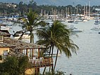
Ilhabela (Portuguese for Beautiful Island) is an archipelago and city situated in the Atlantic Ocean six kilometres (4 miles) off the coast of São Paulo state in Brazil. The city is 205 km (127 mi) from the city of São Paulo and 340 km (210 mi) from the city of Rio de Janeiro. The largest island, although commonly called Ilhabela, is officially named Ilha de São Sebastião (St. Sebastian Island). It, the other islands (Búzios, Pescadores and Vitória) and the islets (Cabras, Castelhanos, Enchovas, Figueira, Lagoa and Serraria) make up the municipality of Ilhabela.
Ilhabela is part of the Metropolitan Region of Vale do Paraíba e Litoral Norte.[3] The population is 35,591 (2020 est.).[4] The islands in total cover 347.52 km2 (134.18 sq mi).[4] During the holiday months, up to one hundred thousand people may be on the island,[5] since it is a popular destination for tourists. To access the city, one must take a boat or ferry in São Sebastião, as there are no roads which reach it. During the summer, one may wait several hours to take the ferry boat. The ferry takes 15 minutes to cross the channel between the two cities.
- ^ "IBGE 2020". Archived from the original on 2021-12-03. Retrieved 2021-01-25.
- ^ "Archived copy" (PDF). United Nations Development Programme (UNDP). Archived from the original (PDF) on July 8, 2014. Retrieved August 1, 2013.
{{cite web}}: CS1 maint: archived copy as title (link) - ^ "Assembleia Legislativa do Estado de São Paulo, Lei Complementar Nº 1.166". Archived from the original on 2022-06-25. Retrieved 2015-10-02.
- ^ a b "Instituto Brasileiro de Geografia e Estatística". Archived from the original on 2015-09-28. Retrieved 2015-10-02.
- ^ Bueno, Chris (1 June 2010). "Ilhabela: Conheça as belezas da maior ilha marítima brasileira!" (in Portuguese). 360 Graus. Archived from the original on 23 August 2014. Retrieved 8 January 2012.


