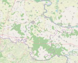
Ilok | |
|---|---|
| Grad Ilok Town of Ilok | |
Photographs of Ilok | |
 | |
| Coordinates: 45°13′19″N 19°22′31″E / 45.22194°N 19.37528°E | |
| Country | |
| Region | Syrmia (Podunavlje) |
| County | |
| Government | |
| • Mayor | Marina Budimir (Ind.) |
| Area | |
| • Town | 129.0 km2 (49.8 sq mi) |
| • Urban | 57.7 km2 (22.3 sq mi) |
| Elevation | 110 m (360 ft) |
| Population (2021)[2] | |
| • Town | 5,045 |
| • Density | 39/km2 (100/sq mi) |
| • Urban | 3,842 |
| • Urban density | 67/km2 (170/sq mi) |
| Demonym(s) | Iločanin (♂) Iločanka (♀) (per grammatical gender) |
| Time zone | UTC+1 (CET) |
| • Summer (DST) | UTC+2 (CEST) |
| Postal code | 32236 |
| Area code | +385 (0)32 |
| Website | ilok |

Ilok (pronounced [ilok]) is the easternmost town in Croatia forming a geographic salient surrounded by Vojvodina. Located in the Syrmia region, it lies on the Fruška Gora hill overlooking the Danube river, which forms the border with the Bačka region of Serbia. The town is home to a Franciscan monastery and Ilok Castle, which is a popular day trip for domestic and cross-border tourists.
- ^ Register of spatial units of the State Geodetic Administration of the Republic of Croatia. Wikidata Q119585703.
- ^ "Population by Age and Sex, by Settlements" (xlsx). Census of Population, Households and Dwellings in 2021. Zagreb: Croatian Bureau of Statistics. 2022.


