Ilopango International Airport Aeropuerto Internacional de Ilopango | |||||||||||||||
|---|---|---|---|---|---|---|---|---|---|---|---|---|---|---|---|
 The airport's old passenger terminal | |||||||||||||||
| Summary | |||||||||||||||
| Airport type | Military and charter | ||||||||||||||
| Owner | Government of El Salvador | ||||||||||||||
| Operator | Autonomous Port Executive Commission (CEPA) | ||||||||||||||
| Serves | San Salvador | ||||||||||||||
| Location | Ilopango, El Salvador | ||||||||||||||
| Time zone | CST (UTC–6) | ||||||||||||||
| Elevation AMSL | 2,027 ft / 618 m | ||||||||||||||
| Coordinates | 13°41′30″N 089°07′32″W / 13.69167°N 89.12556°W | ||||||||||||||
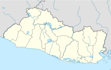
| Map | |||||||||||||||
 | |||||||||||||||
| Runways | |||||||||||||||
| |||||||||||||||
Ilopango International Airport (IATA: ILS, ICAO: MSSS) is an airport located on the eastern part of the city of San Salvador, El Salvador, once serving the city as its international airport until 1980 when it was replaced by the larger and more modern El Salvador International Airport, located about 50 km south of the city. Currently, Ilopango is used for military, air taxi, and charter aviation only. It also holds the annual Ilopango Air Show. The airport is also home to the National Aviation Museum (Museo Nacional de Aviación) of San Salvador, which is housed in the old terminal building.
- ^ "Ais | MSLP - El Salvador". Archived from the original on 27 July 2013. Retrieved 20 August 2011.
- ^ "Airport information for MSLP". World Aero Data. Archived from the original on 5 March 2019.
{{cite web}}: CS1 maint: unfit URL (link) Data current as of October 2006. Source: DAFIF.
