Imlay, Nevada | |
|---|---|
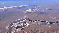
 Imlay (at lower right) is near the Lassens Meadows, above Rye Patch Reservoir, on the Humboldt River. | |
| Coordinates: 40°39′39″N 118°09′02″W / 40.66083°N 118.15056°W[1] | |
| Country | United States |
| State | Nevada |
| Area | |
• Total | 1.18 sq mi (3.06 km2) |
| • Land | 1.18 sq mi (3.06 km2) |
| • Water | 0.00 sq mi (0.00 km2) |
| Elevation | 4,203 ft (1,281 m) |
| Population (2020) | |
• Total | 210 |
| • Density | 177.66/sq mi (68.58/km2) |
| Time zone | UTC-8 (Pacific (PST)) |
| • Summer (DST) | UTC-7 (PDT) |
| ZIP code | 89418[3] |
| Area code | 775 |
| FIPS code | 32-34700 |
| GNIS feature ID | 0841225[1] |
Imlay is an unincorporated town in Pershing County, Nevada, United States.[4] It has an elementary school, a general store, a post office, and a trading post. As of the 2010 census, the population was 171.[5]
It is a nearly abandoned railroad town, named for a nearby mine or for the civil engineer who surveyed the town circa 1907.[6][7] Its most notable feature is a series of strange buildings called Thunder Mountain Monument. These structures were built as a monument to Native American culture by a World War II veteran who called himself Thunder.[8]
Michael Feldman's Whad'Ya Know? public radio show featured Imlay as the "Town of the Week" on its December 5, 2009, show. They mentioned Thunder Mountain Monument[9] as one of the premier draws to the area.

- ^ a b c U.S. Geological Survey Geographic Names Information System: Imlay, Nevada
- ^ "ArcGIS REST Services Directory". United States Census Bureau. Retrieved September 19, 2022.
- ^ "Imlay NV ZIP Code". zipdatamaps.com. 2023. Retrieved June 16, 2023.
- ^ "Pershing County Code - Chapter 2.44: Unincorporated Town of Imlay". Sterling Codifiers. Retrieved January 31, 2017.
- ^ "Geographic Identifiers: 2010 Demographic Profile Data (G001): Imlay CDP, Nevada". U.S. Census Bureau, American Factfinder. Archived from the original on February 12, 2020. Retrieved January 28, 2013.
- ^ Basso, Dave (1970). Ghosts of Humboldt Region. Sparks, Nevada: Western Printing and Publishing. p. 40. States that Imlay was named for a mine. Contains 6 historic photos of Imlay.
- ^ Leigh, Rufus Wood (1964). Nevada Place Names: Their Origin and Significance. Salt Lake City: Desert News Press. p. 27. States that Imlay was named for a civil engineer.
- ^ "Pershing County". Archived from the original on May 21, 2006.
- ^ "Thunder Mountain Monument, a monument to the Native American People". Archived from the original on May 27, 2010.

