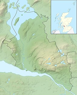
| Scottish Gaelic name | Innis Taigh a' Mhanaich |
|---|---|
| Meaning of name | island of the monk's house |
| Location | |
| OS grid reference | NS365915 |
| Coordinates | 56°05′N 4°38′W / 56.08°N 4.63°W |
| Physical geography | |
| Island group | Loch Lomond |
| Area | 70 ha[1] |
| Area rank | 174= (Freshwater: 4) [2] |
| Highest elevation | Tom na Clag 84 m |
| Administration | |
| Council area | Argyll and Bute |
| Country | Scotland |
| Sovereign state | United Kingdom |
| Demographics | |
| Population | 3[3] |
| Population rank | 80= (Freshwater: 2=) [2] |
| References | [4][5] |
Inchtavannach (Scottish Gaelic: Innis Taigh a' Mhanaich; English: Island of the Monk's House), is one of the larger islands in Loch Lomond.[6]
- ^ Rick Livingstone’s Tables of the Islands of Scotland (pdf) Argyll Yacht Charters. Retrieved 12 Dec 2011.
- ^ a b Area and population ranks: there are c. 300 islands over 20 ha in extent and 93 permanently inhabited islands were listed in the 2011 census.
- ^ National Records of Scotland (15 August 2013). "Appendix 2: Population and households on Scotland's Inhabited Islands" (PDF). Statistical Bulletin: 2011 Census: First Results on Population and Household Estimates for Scotland Release 1C (Part Two) (PDF) (Report). SG/2013/126. Retrieved 14 August 2020.
- ^ Ordnance Survey: Landranger map sheet 56 Loch Lomond & Inveraray (Map). Ordnance Survey. 2012. ISBN 9780319229811.
- ^ Lacaille, AD (9 January 1928). "Ecclesiastical Remains in the Neighbourhood of Luss" (PDF). Proceedings of the Society of Antiquaries of Scotland. 62: 85–106.
- ^ Garnett, T. (1800). Observations on a Tour of the Highlands ... London. V.1. p. 38.
