| Inda Sillasie River | |
|---|---|
 The Inda Sillasie River at Dabba Hadera | |
Inda Sillasie River in Tigray Region | |
| Location | |
| Country | Ethiopia |
| Region | Tigray Region |
| Districts (woreda) | Dogu’a Tembien, xxx |
| Physical characteristics | |
| Source | May Zegzeg River |
| • elevation | 1,970 m (6,460 ft) |
| 2nd source | May Be'ati River |
| Mouth | Giba River |
• location | Down from Addi Lihtsi in Amanit municipality |
• coordinates | 13°29′28″N 39°12′36″E / 13.491°N 39.21°E |
• elevation | 1,470 m (4,820 ft) |
| Length | 19 km (12 mi) |
| Basin size | 121 km2 (47 sq mi) |
| Width | |
| • average | 18 m (59 ft) |
| Discharge | |
| • location | At the outlet, near Inda Sillasie monastery[1] |
| • maximum | 172 m3/s (6,100 cu ft/s) |
| Basin features | |
| River system | Permanent river |
| Landmarks | Rubaksa; Dabba Hadera and Inda Sillasie monasteries |
| Waterfalls | Rapids |
| Bridges | Footbridge at Rubaksa |
| Topography | Mountains and deep gorges |
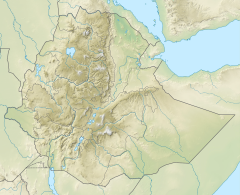
The Inda Sillasie is a river of northern Ethiopia. It originates at the confluence of May Zegzeg and May Be'ati Rivers in the mountains of Dogu’a Tembien (1970 metres above sea level), and flows southward to Giba River which empties finally in the Tekezé River. Along its course, it first takes the name Rubaksa River, then Dabba Hadera River, and finally Inda Sillasie River.[2]

- ^ Amanuel Zenebe, and colleagues (2013). "Spatial and temporal variability of river flows in the degraded semi-arid tropical mountains of northern Ethiopia" (PDF). Zeitschrift für Geomorphologie. 57 (2): 143–169. Bibcode:2013ZGm....57..143Z. doi:10.1127/0372-8854/2012/0080.
- ^ Jacob, M. and colleagues (2019). Geo-trekking map of Dogu'a Tembien (1:50,000). In: Geo-trekking in Ethiopia's Tropical Mountains - The Dogu'a Tembien District. SpringerNature. ISBN 978-3-030-04954-6.
