Indian River, Michigan | |
|---|---|
 Looking north along S. Straits Highway | |
 Location within Cheboygan County | |
| Coordinates: 45°24′45″N 84°36′45″W / 45.41250°N 84.61250°W | |
| Country | United States |
| State | Michigan |
| County | Cheboygan |
| Township | Tuscarora |
| Settled | 1876 |
| Platted | 1880 |
| Area | |
• Total | 20.29 sq mi (52.54 km2) |
| • Land | 12.93 sq mi (33.48 km2) |
| • Water | 7.36 sq mi (19.06 km2) |
| Elevation | 614 ft (187 m) |
| Population (2020) | |
• Total | 1,950 |
| • Density | 150.85/sq mi (58.24/km2) |
| Time zone | UTC-5 (Eastern (EST)) |
| • Summer (DST) | UTC-4 (EDT) |
| ZIP code(s) | 49749 |
| Area code | 231 |
| FIPS code | 26-40480[3] |
| GNIS feature ID | 0629015[2] |

Indian River is an unincorporated community and census-designated place (CDP) in Cheboygan County in the U.S. state of Michigan. The population was 1,950 at the 2020 census. The CDP is located in Tuscarora Township between Burt Lake and Mullett Lake.
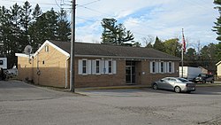
As an unincorporated community, Indian River has no legal autonomy of its own but does have its own post office with the 49749 ZIP Code, which also serves small portions of several surrounding townships.[4][5]
- ^ "2020 U.S. Gazetteer Files". United States Census Bureau. Retrieved May 21, 2022.
- ^ a b U.S. Geological Survey Geographic Names Information System: Indian River, Michigan
- ^ "U.S. Census website". United States Census Bureau. Retrieved January 31, 2008.
- ^ UnitedStatesZipCodes.org (2021). "ZIP Code 49749: Indian River". Retrieved November 6, 2022.
- ^ "49749 ZIP Code map" (Map). Google Maps. Retrieved November 6, 2022.

