Indianapolis Metropolitan Airport | |||||||||||
|---|---|---|---|---|---|---|---|---|---|---|---|
 | |||||||||||
| Summary | |||||||||||
| Airport type | Public | ||||||||||
| Owner | Indianapolis Airport Authority | ||||||||||
| Operator | Tom Wood Aviation | ||||||||||
| Serves | Indianapolis, Indiana | ||||||||||
| Location | Fishers, Indiana | ||||||||||
| Elevation AMSL | 811 ft / 247 m | ||||||||||
| Coordinates | 39°56′07″N 086°02′42″W / 39.93528°N 86.04500°W | ||||||||||
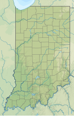
| Map | |||||||||||
 | |||||||||||
| Runways | |||||||||||
| |||||||||||
| Statistics | |||||||||||
| |||||||||||
Indianapolis Metropolitan Airport (ICAO: KUMP, FAA LID: UMP) is a public airport in Fishers, Hamilton County, Indiana, United States. It is 8 miles (13 km) northeast of downtown Indianapolis, is owned by the Indianapolis Airport Authority and is a reliever airport for Indianapolis International Airport.[1]
Most U.S. airports use the same three-letter location identifier for the FAA and IATA, but Indianapolis Metropolitan Airport is "UMP" to the FAA and has no IATA code.[2]
- ^ a b FAA Airport Form 5010 for UMP PDF, effective June 21, 2018.
- ^ Great Circle Mapper: KUMP - Indianapolis, Indiana - Indianapolis Metropolitan Airport

