Inhauna | |
|---|---|
Village | |
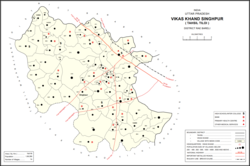
 Map showing Inhauna (#037) in Singhpur CD block | |
| Coordinates: 26°31′28″N 81°29′35″E / 26.524578°N 81.492961°E[1] | |
| Country India | |
| State | Uttar Pradesh |
| District | Raebareli |
| Area | |
| • Total | 8.62 km2 (3.33 sq mi) |
| Population (2011)[2] | |
| • Total | 13,049 |
| • Density | 1,500/km2 (3,900/sq mi) |
| Languages | |
| • Official | Hindi |
| Time zone | UTC+5:30 (IST) |
| PIN | 229308[2] |
| Vehicle registration | UP-33 |
Inhauna is a village and corresponding in Singhpur block of Rae Bareli district, Uttar Pradesh, India.[2] As of 2011, its population is 13,049, in 2,021 households.[2] Located at the junction of the Raebareli-Rudauli and Lucknow-Jaunpur roads, Inhauna is an old town that once served as the seat of a pargana as well as (briefly) a tehsil, and it has the ruins of an old fort built under the Nawabs of Awadh.[3] The old marketplace, known as Ratanganj, was built in 1863 by the tahsildar Ratan Narain.[3] Markets are held twice per week, on Mondays and Thursdays, and most of the trade is in livestock.[4]
- ^ "Geographic Names Search WebApp". Search for "Inhauna" here.
- ^ a b c d e "Census of India 2011: Uttar Pradesh District Census Handbook - Rae Bareli, Part A (Village and Town Directory)" (PDF). Census 2011 India. pp. 125–41. Retrieved 29 July 2021.
- ^ a b Nevill, H.R. (1905). Rai Bareli: A Gazetteer, Being Volume XXXIX Of The District Gazetteers Of The United Provinces Of Agra And Oudh. Allahabad: Government Press. pp. 108–9, 140, 177–80. Retrieved 29 July 2021.
- ^ Census 1961: District Census Handbook, Uttar Pradesh (39 - Raebareli District) (PDF). Lucknow. 1965. pp. 173, xviii-xix of section "Maharajganj Tahsil". Retrieved 29 July 2021.
{{cite book}}: CS1 maint: location missing publisher (link)
