Inveraray
| |
|---|---|
 | |
Location within Argyll and Bute | |
| Population | 570 (2022)[3] |
| OS grid reference | NN 09600 08500 |
| • Edinburgh | 75[4] mi (121 km) |
| • London | 383[5] mi (616 km) |
| Council area |
|
| Lieutenancy area |
|
| Country | Scotland |
| Sovereign state | United Kingdom |
| Post town | INVERARAY |
| Postcode district | PA32 |
| Dialling code | 01499 |
| UK Parliament | |
| Scottish Parliament |
|
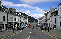
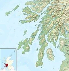
Inveraray (/ˌɪnvəˈrɛəri/ or /ˌɪnvəˈrɛərə/; Scottish Gaelic: Inbhir Aora pronounced [iɲɪɾʲˈɯːɾə] meaning "mouth of the Aray") is a town in Argyll and Bute, Scotland. It is on the western shore of Loch Fyne, near its head, and on the A83 road. It is a former royal burgh, the traditional county town of Argyll, and ancestral seat to the Duke of Argyll. Known affectionately as "The Capital of Argyll"
During the Second World War the Combined Operations Training Centre, located close to the town, was an important military facility.[6]
- ^ "StackPath". www.ainmean-aite.org.
- ^ "Scotslanguage.com - Names in Scots - Places in Scotland".
- ^ "Mid-2020 Population Estimates for Settlements and Localities in Scotland". National Records of Scotland. 31 March 2022. Retrieved 31 March 2022.
- ^ "Distance from Inveraray, UK to Edinburgh, UK or how far is Inveraray, UK from Edinburgh, UK?". Retrieved 27 November 2018.
- ^ "Distance from Inveraray, UK to London, UK or how far is Inveraray, UK from London, UK?". Retrieved 27 November 2018.
- ^ "No. 1 Combined Training Centre, Inveraray". Combinedops.com. Retrieved 1 February 2017.
