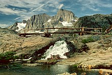
| Inyo National Forest | |
|---|---|
 Hikers can access Mount Whitney, highest point in the contiguous United States, through the Inyo National Forest | |
Map of the United States | |
| Location | Eastern Sierra Nevada Range |
| Nearest city | Bishop, California |
| Coordinates | 37°50′N 118°59.5′W / 37.833°N 118.9917°W[1] |
| Area | 1,903,381 acres (7,702.71 km2)[2] |
| Established | May 25, 1907[3] |
| Governing body | U.S. Forest Service |
| Website | Inyo National Forest |


Inyo National Forest is a United States National Forest covering parts of the eastern Sierra Nevada of California and the White Mountains of California and Nevada. The forest hosts several superlatives, including Mount Whitney, the highest point in the contiguous United States; Boundary Peak, the highest point in Nevada; and the Ancient Bristlecone Pine Forest, which protects the oldest living trees in the world. The forest, encompassing much of the Owens Valley, was established by Theodore Roosevelt as a way of sectioning off land to accommodate the Los Angeles Aqueduct project in 1907, making the Inyo National Forest one of the least wooded forests in the U.S. National Forest system.[4]
- ^ "Inyo National Forest". Geographic Names Information System. United States Geological Survey, United States Department of the Interior.
- ^ "Land Areas of the National Forest System" (PDF). U.S. Forest Service. January 2012. Retrieved June 26, 2012.
- ^ "The National Forests of the United States" (PDF). ForestHistory.org. Archived from the original (PDF) on October 28, 2012. Retrieved June 26, 2012.
- ^ Reisner, Marc (1993). Cadillac Desert: The American West and its Disappearing Water. New York: Penguin Books. ISBN 0140178244.

