Iowa City Municipal Airport | |||||||||||||||
|---|---|---|---|---|---|---|---|---|---|---|---|---|---|---|---|
| Summary | |||||||||||||||
| Airport type | Public | ||||||||||||||
| Owner | City of Iowa City | ||||||||||||||
| Serves | Iowa City, Iowa | ||||||||||||||
| Elevation AMSL | 683 ft / 208 m | ||||||||||||||
| Coordinates | 41°38′21″N 91°32′47″W / 41.63917°N 91.54639°W | ||||||||||||||
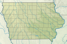
| Map | |||||||||||||||
 | |||||||||||||||
| Runways | |||||||||||||||
| |||||||||||||||
| Statistics | |||||||||||||||
| |||||||||||||||
Iowa City Municipal Airport (IATA: IOW, ICAO: KIOW, FAA LID: IOW), is two miles southwest of downtown Iowa City, in Johnson County, Iowa.[1] It is the oldest civil airport west of the Mississippi River still in its original location.[3][4]
The Federal Aviation Administration (FAA) National Plan of Integrated Airport Systems for 2017–2021 categorized it as a regional general aviation facility.[5]
The airport has no scheduled airline service; the closest airline airport is The Eastern Iowa Airport in Cedar Rapids, about 19 miles (31 km) northwest. In the 1920s Iowa City was on the original transcontinental air route, flown by Boeing Air Transport, a United predecessor. On March 1, 1959, United was replaced by Ozark, which pulled out of Iowa City in April 1970.
- ^ a b FAA Airport Form 5010 for IOW PDF. Federal Aviation Administration. effective December 7, 2017.
- ^ "History of the Iowa City Municipal Airport | City of Iowa City".
- ^ Daly Bednarek, Janet R. (2008). "Iowa City Municipal Airport: Opening the West to Aviation, 1918-2007". The Annals of Iowa. 67 (2): 243–244. doi:10.17077/0003-4827.1241.
- ^ "List of NPIAS Airports" (PDF). FAA.gov. Federal Aviation Administration. October 21, 2016. p. 29. Retrieved August 21, 2017.

