Iron Junction, Minnesota | |
|---|---|
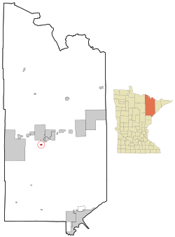
 Location of the city of Iron Junction within Saint Louis County, Minnesota | |
| Coordinates: 47°25′1″N 92°36′16″W / 47.41694°N 92.60444°W | |
| Country | United States |
| State | Minnesota |
| County | Saint Louis |
| Incorporated | 1893 |
| Government | |
| • Mayor | Travis McDonald |
| Area | |
| • Total | 0.812 sq mi (2.102 km2) |
| • Land | 0.812 sq mi (2.102 km2) |
| • Water | 0.000 sq mi (0.000 km2) |
| Elevation | 1,385 ft (422 m) |
| Population | |
| • Total | 110 |
| • Estimate (2022)[4] | 107 |
| • Density | 135.47/sq mi (52.33/km2) |
| Time zone | UTC–6 (Central (CST)) |
| • Summer (DST) | UTC–5 (CDT) |
| ZIP Code | 55751 |
| Area code | 218 |
| FIPS code | 27-31238 |
| GNIS feature ID | 0661552[2] |
| Sales tax | 7.375%[5] |
Iron Junction is a city in Saint Louis County, Minnesota, United States. The population was 110 at the 2020 census.[3]
Saint Louis County Highway 7 and Iron Junction Road serve as main routes in the community. State Highway 37 (MN 37) is nearby.
The name Iron Junction, as a place of residence, is seldom used today by its residents. Those who reside in this community simply identify themselves as a resident of Iron. The road signs posted in the community also simply read "Iron".[citation needed]
The city of Iron Junction is located within Clinton Township geographically but is a separate entity.
- ^ "2023 U.S. Gazetteer Files". United States Census Bureau. Retrieved July 24, 2022.
- ^ a b U.S. Geological Survey Geographic Names Information System: Iron Junction, Minnesota
- ^ a b "Explore Census Data". United States Census Bureau. Retrieved January 28, 2024.
- ^ Cite error: The named reference
USCensusEst2022was invoked but never defined (see the help page). - ^ "Iron Junction (MN) sales tax rate". Retrieved January 28, 2024.