| Scottish Gaelic name | Ìosaigh |
|---|---|
| Pronunciation | [ˈiəs̪aj] |
| Old Norse name | isa-ey |
| Meaning of name | "porpoise island"[dubious – discuss] |
 Isay from the coral beaches on Skye | |
| Location | |
| OS grid reference | NG218570 |
| Coordinates | 57°31′N 6°39′W / 57.52°N 6.65°W |
| Physical geography | |
| Island group | Isle of Skye |
| Area | 60 ha (1⁄4 sq mi)[1] |
| Area rank | 182 [2] |
| Highest elevation | 28 m (92 ft) |
| Administration | |
| Council area | Highland |
| Country | Scotland |
| Sovereign state | United Kingdom |
| Demographics | |
| Population | 0 |
| References | [3][4][5] |
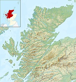
Isay (Scottish Gaelic: Ìosaigh) is an uninhabited island in the Inner Hebrides of the west coast of Scotland. It lies in Loch Dunvegan, 1 kilometre (1,100 yd) off the northwest coast of the Isle of Skye. Two smaller isles of Mingay and Clett lie nearby. The name originated from the Old Norse ise-øy meaning porpoise island. The island of Lampay is due south. The area of Isay is 60 hectares (150 acres).[1]

- ^ a b "Rick Livingstone’s Tables of the Islands of Scotland" (pdf) Argyll Yacht Charters. Retrieved 23 September 2013.
- ^ Area and population ranks: there are c. 300 islands over 20 ha in extent and 93 permanently inhabited islands were listed in the 2011 census.
- ^ General Register Office for Scotland (28 November 2003) Scotland's Census 2001 – Occasional Paper No 10: Statistics for Inhabited Islands. Retrieved 26 February 2012.
- ^ Haswell-Smith, Hamish (2004). The Scottish Islands. Edinburgh: Canongate. pp. 166–68. ISBN 978-1-84195-454-7.
- ^ Ordnance Survey. OS Maps Online (Map). 1:25,000. Leisure.
