| Ise Bay 伊勢湾 | |
|---|---|
 Ise Bay as seen from Ise City Skyline | |
| Coordinates | 34°45′N 136°45′E / 34.750°N 136.750°E |
| River sources | Kiso Three Rivers, Nikkō River, Shōnai River, Tempaku River |
| Ocean/sea sources | Pacific Ocean |
| Basin countries | Japan |
| Surface area | 1,738 km2 (671 sq mi) |
| Average depth | 19.5 m (64 ft) |
| Max. depth | 30 m (98 ft) |
| Water volume | 33.9 km3 (8.1 cu mi) |
| Islands | Centrair airport (artificial) |
| Settlements | Nagoya Yokkaichi Tsu Matsusaka Ise |
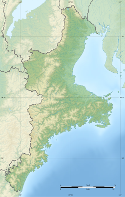
Ise Bay (伊勢湾, Ise-wan) is a bay located at the mouth of the Kiso Three Rivers between Mie and Aichi Prefectures in Japan. Ise Bay has an average depth of 19.5 meters (64 ft) and a maximum depth of 30 meters (98 ft). The mouth of the bay is 9 kilometers (5.6 mi) and is connected to the smaller Mikawa Bay by two channels: the Nakayama Channel and the Morosaki Channel. Mikawa Bay is subsequently joined to the Pacific Ocean[1] by the Irako Channel, which ranges from 50–100 meters (160–330 ft) in depth.
- ^ Fujiwara, T; Takahashi, T; Kasai, A; Sugiyama, Y; Kuno, M (2002), "The Role of Circulation in the Development of Hypoxia in Ise Bay, Japan", Estuarine, Coastal and Shelf Science, 54 (1): 19–31, Bibcode:2002ECSS...54...19F, doi:10.1006/ecss.2001.0824

