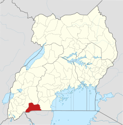
Isingiro District | |
|---|---|
 District location in Uganda | |
| Coordinates: 00°50′S 30°50′E / 0.833°S 30.833°E | |
| Country | |
| Region | Western Uganda |
| Sub-region | Ankole sub-region |
| Capital | Isingiro |
| Area | |
• Total | 2,655.6 km2 (1,025.3 sq mi) |
| Population (2012 Estimate) | |
• Total | 420,200 |
| • Density | 158.2/km2 (410/sq mi) |
| Time zone | UTC+3 (EAT) |
| Area code | 062 |
| Website | www |
Isingiro District is a district in the Western Region of Uganda. The town of Isingiro is the district's main municipal, administrative, and commercial center.