 Iguana at the marine lab on Isla Magueyes | |
| Geography | |
|---|---|
| Location | Caribbean |
| Coordinates | 17°58′08″N 67°02′39″W / 17.96889°N 67.04417°W |
| Archipelago | Greater Antilles |
| Area | 0.072 km2 (0.028 sq mi) |
| Administration | |
| Additional information | |
| Time zone | |
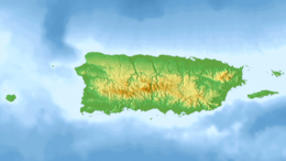
Isla Magueyes (Isle of Maguey) is a 7.2 hectares (0.028 sq mi; 0.072 km2) island 50 metres (160 ft) from the southwest coast of the island of Puerto Rico.[1] It is encircled with mangrove and has an interior of dry scrub habitat, where it gets its name.[2] It is named for the presence of many century plants or maguey (Agave americana). The surrounding shelf of the island is mostly coral reef. There are buildings on the western end of the island associated with the Department of Marine Sciences, University of Puerto Rico at Mayagüez.[3] UPR- Mayagüez is an important center in the Atlantic region for the study of tropical marine science due to its location, facilities, and first-rate researchers.[4] The research facilities includes the Puerto Rico Water Resources and Environmental Research Institute, the Caribbean Coral Reef Institute (CCRI), the Research and Development Center, the Agricultural Research Station and the Caribbean Atmospheric Research Center (ATMOSCarib).[3][4]
- ^ Allison Alberts (2004). Iguanas: biology and conservation. University of California Press. p. 217. ISBN 0-520-23854-0.
- ^ Cite error: The named reference
Cohenwas invoked but never defined (see the help page). - ^ a b "Department of Marine Sciences". University of Puerto Rico – Mayagüez (UPRM). Retrieved December 20, 2009.
- ^ a b "Caribbean Coral Reef Institute Website". University of Puerto Rico – Mayagüez (UPRM). Retrieved December 20, 2009.


