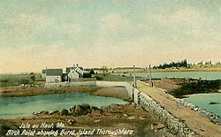
Isle au Haut, Maine | |
|---|---|
 Birch Point and Burnt Island Thoroughfare c. 1908 | |
 Location in Knox County and the state of Maine. | |
| Coordinates: 44°3′32″N 68°37′1″W / 44.05889°N 68.61694°W | |
| Country | United States |
| State | Maine |
| County | Knox |
| Incorporated | 1874 |
| Villages | Isle Au Haut Lookout |
| Area | |
| • Total | 113.20 sq mi (293.19 km2) |
| • Land | 12.52 sq mi (32.43 km2) |
| • Water | 100.68 sq mi (260.76 km2) |
| Elevation | 0 ft (0 m) |
| Population | |
| • Total | 92 |
| • Density | 1.2/sq mi (3.2/km2) |
| Time zone | UTC-5 (Eastern (EST)) |
| • Summer (DST) | UTC-4 (EDT) |
| ZIP code | 04645 |
| Area code | 207 |
| FIPS code | 23-35135 |
| GNIS feature ID | 0582530 |
Isle au Haut (/ˈaɪ.lə.hoʊ/) is a town in Knox County, Maine, United States, on an island of the same name in Penobscot Bay. The population was 92 at the 2020 census.[2] Home to portions of Acadia National Park, Isle au Haut is accessible by ferry from Stonington. The 6 mile ride takes about 45 minutes.
- ^ Cite error: The named reference
Gazetteer fileswas invoked but never defined (see the help page). - ^ a b Trotter, Bill (August 20, 2021). "More people have moved to Maine's remote islands in the last decade". Bangor Daily News. Retrieved August 20, 2021.