| Islington Newcastle, New South Wales | |||||||||||||||
|---|---|---|---|---|---|---|---|---|---|---|---|---|---|---|---|
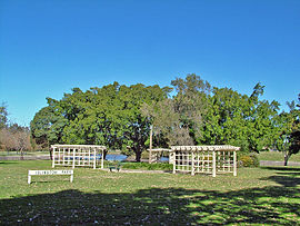
 Islington Park, looking towards Throsby Creek | |||||||||||||||
| Coordinates | 32°54′57″S 151°44′46″E / 32.91583°S 151.74611°E | ||||||||||||||
| Population | 1,883 (2016 census)[1] | ||||||||||||||
| • Density | 2,145/km2 (5,560/sq mi) | ||||||||||||||
| Established | 1870s | ||||||||||||||
| Postcode(s) | 2296 | ||||||||||||||
| Elevation | 8 m (26 ft) | ||||||||||||||
| Area | 0.713 km2 (0.3 sq mi)Note1 | ||||||||||||||
| Location | |||||||||||||||
| LGA(s) | City of Newcastle[2][3] | ||||||||||||||
| Region | Hunter[2] | ||||||||||||||
| County | Northumberland[3] | ||||||||||||||
| Parish | Newcastle[3] | ||||||||||||||
| State electorate(s) | Newcastle[4] | ||||||||||||||
| Federal division(s) | Newcastle[5] | ||||||||||||||
| |||||||||||||||
| |||||||||||||||
Islington (/ˈɪzlɪŋtən/ IZ-ling-tən)[6] is a suburb of the city of Newcastle in the Hunter Region of New South Wales, Australia.[2][3] Located only 3.4 kilometres (2.1 mi) from the Newcastle CBD on one of Newcastle's major arterial roads, it was initially developed as a residential suburb. Today it includes a small industrial area and is adjacent to the Newcastle campus of the Hunter Institute of Technology. Its southeastern border is occupied entirely by the Main Northern railway line.[7] The suburb has one railway station, which is shared with, and named after, adjacent Hamilton.
- ^ Australian Bureau of Statistics (27 June 2017). "Islington (State Suburb)". 2016 Census QuickStats. Retrieved 9 February 2018.
- ^ a b c "Suburb Search – Local Council Boundaries – Hunter (HT) – Newcastle City Council". New South Wales Division of Local Government. 17 October 2008. Retrieved 27 March 2009.
- ^ a b c d "Islington". Geographical Names Register (GNR) of NSW. Geographical Names Board of New South Wales. Retrieved 27 March 2009.
- ^ "Newcastle". New South Wales Electoral Commission. Retrieved 23 November 2019.
- ^ "Newcastle". Australian Electoral Commission. 10 January 2007. Retrieved 27 March 2009.
- ^ "Search By Letter – ABC PRONOUNCE". Australian Broadcasting Corporation. Archived from the original on 11 February 2017. Retrieved 10 February 2017.
- ^ "Islington". Land and Property Management Authority - Spatial Information eXchange. New South Wales Land and Property Information. Retrieved 27 March 2009.
