Itapetininga | |
|---|---|
 Largo dos Amores square at night | |
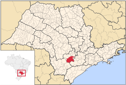
 Location in São Paulo state | |
| Coordinates: 23°35′30″S 48°3′11″W / 23.59167°S 48.05306°W | |
| Country | Brazil |
| Region | Southeast |
| State | São Paulo |
| Government | |
| • Mayor | Jeferson Brun |
| Area | |
| • Total | 1,790 km2 (690 sq mi) |
| Population (2020 [1]) | |
| • Total | 165,526 |
| • Density | 92/km2 (240/sq mi) |
| Time zone | UTC-03:00 (BRT) |
| • Summer (DST) | UTC-02:00 (BRST) |
| Area code | 15 |
Itapetininga is a municipality in the state of São Paulo, Brazil. The population is 165,526 (2020 est.) in an area of 1790 km2.[2] The name comes from a Tupi-Guarani language, meaning "dry stone".[3]
The city is the seat of the Government Region of Itapetininga, made up of twelve other municipalities: Alambari, Angatuba, Boituva, Campina do Monte Alegre, Capela do Alto, Cerquilho, Cesário Lange, Guareí, Quadra, São Miguel Arcanjo, Sarapuí and Tatuí, which together have more than 520 thousand inhabitants.[4]
It is situated in the southern part of the state, and is known as cidade das escolas, meaning city of schools in Portuguese.
- ^ IBGE 2020
- ^ Instituto Brasileiro de Geografia e Estatística
- ^ IBGE, history
- ^ itapetininga.net.br. "itapetininga.net.br | Guia de empresas e serviços em Itapetininga". itapetininga.net.br (in Portuguese). Retrieved 2024-10-23.


