Itarhi | |
|---|---|
Nagar Panchayat | |
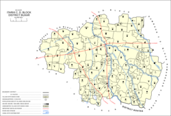
 Map of Itarhi in Itarhi block | |
| Coordinates: 25°29′00″N 84°00′47″E / 25.48324°N 84.01294°E[1] | |
| Country | |
| State | Bihar |
| District | Buxar |
| Area | |
| • Total | 3.622 km2 (1.398 sq mi) |
| Elevation | 70 m (230 ft) |
| Population (2011)[2] | |
| • Total | 10,275 |
| • Density | 2,800/km2 (7,300/sq mi) |
| Languages | |
| • Official | Hindi |
| • Local | Bhojpuri |
| Time zone | UTC+5:30 (IST) |
Itarhi (Hindi: इटाढ़ी) is a Nagar Panchayat and corresponding community development block in Buxar district of Bihar, India. According to the 2011 Census of India, its population is 10,275, in 1,711 households, while the total block population is 170,629, in 25,557 households.[2]
- ^ a b "Geonames.org. Itārhi". Retrieved 15 July 2020.
- ^ a b c d "Census of India 2011: Bihar District Census Handbook - Buxar, Part A (Village and Town Directory)". Census 2011 India. pp. 19–20, 23–98, 542–621, 681–82, 730–746. Retrieved 13 July 2020.

