Ixmiquilpan
Ntsʼu̱tkʼani | |
|---|---|
Town and Municipality | |
 Main plaza of Ixmiquilpan | |
| Coordinates: 20°28′55″N 99°13′05″W / 20.48194°N 99.21806°W | |
| Country | |
| State | Hidalgo |
| Municipality | Ixmiquilpan |
| Founded | 1550 |
| Government | |
| • Municipal President (Major) | José Manuel Zúñiga Guerrrero (2006–2009) |
| Area | |
| • Municipality | 565.3 km2 (218.3 sq mi) |
| Elevation (of seat) | 1,700 m (5,600 ft) |
| Population (2020) | |
| • Municipality | 98,654 |
| • Seat | 98,654 |
| Time zone | UTC-6 (Central (US Central)) |
| • Summer (DST) | UTC-5 (Central) |
| Postal code (of seat) | 42300 |
| Website | (in Spanish) site |
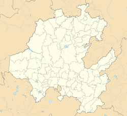
Ixmiquilpan (Otomi: Ntsʼu̱tkʼani) is a city and one of the 84 municipalities of Hidalgo, in central-eastern Mexico. It is located on the Mexico City/Nuevo Laredo Highway at km 170 in the central west part of the state of Hidalgo. The town of Ixmiquilpan is noted for its parish church, Church of San Miguel Arcángel, which contains a large series of murals done in the 16th century by native artists depicting Eagle and Jaguar warriors in battle, along with other pre-Hispanic imagery.[1][2]
- ^ "The Battle Friezes of Ixmiquilpan". Exploring Colonial Mexico. Archived from the original on 20 April 2009. Retrieved 1 September 2009.
- ^ "ZIDADA HYADI El venerado padre Sol en la Parroquia de Ixmiquilpan" (in Spanish). Arqueologia Mexicana. Archived from the original on 6 February 2010. Retrieved 1 September 2009.


