| Izalco | |
|---|---|
 | |
| Highest point | |
| Elevation | 1,950 m (6,400 ft) |
| Coordinates | 13°48′47″N 89°37′59″W / 13.813°N 89.633°W |
| Geography | |
| Location | El Salvador |
| Parent range | Cordillera de Apaneca |
| Geology | |
| Mountain type | Stratovolcano |
| Last eruption | October to November 1966[1] |
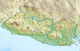
Izalco is an active stratovolcano[2] on the side of the Santa Ana Volcano, which is located in western El Salvador. It is situated on the southern flank of the Santa Ana volcano. Izalco erupted almost continuously from 1770 (when it formed) to 1958[3] earning it the nickname of "Lighthouse of the Pacific", and experienced a flank eruption in 1966.[4] During an eruption in 1926, the village of Matazano was buried and 56 people were killed. The volcano erupted on highly arable land which was used for the production of coffee, cacao, and sugar cane.[5]
- ^ "Izalco". Global Volcanism Program. Smithsonian Institution.
- ^ Carr, M. J.; Pontier, N. K. (1981). Evolution of a young parasitic cone towards a mature central vent; Izalco and Santa Ana volcanoes in El Salvador, Central America. J. Volcanol. Geotherm. Res. pp. 277–292.
- ^ Mooser, F.; Meyer-Abich, H.; McBirney, A. R. (1958). Catalogue of the Active Volcanoes of the World, VI. International Volcanological Association, Naples. p. 146.
- ^ Rose, William I. Jr.; Stoiber, Richard E. (1969). "The 1966 eruption of Izalco volcano, El Salvador". Journal of Geophysical Research. 74 (12): 3119–3130. Bibcode:1969JGR....74.3119R. doi:10.1029/JB074i012p03119.
- ^ Sheets P. D. (2004). Apocalypse then: social science approaches to volcanism, people, and cultures in the Zapotitan Valley, El Salvador. Rose W. I., Bommer J. J., Lopez D. L., Carr M. J., Major J. J. (eds), Natural Hazards in El Salvador. Bolder, Colorado, Geological Society of America Special Paper 375. pp. 109–120.
