| STC rapid transit | |||||||||||
 | |||||||||||
| General information | |||||||||||
| Coordinates | 19°21′28″N 99°05′36″W / 19.357834°N 99.093461°W | ||||||||||
| Line(s) | |||||||||||
| Platforms | 2 side platforms | ||||||||||
| Tracks | 2 | ||||||||||
| Construction | |||||||||||
| Structure type | Underground | ||||||||||
| History | |||||||||||
| Opened | 20 July 1994 | ||||||||||
| Passengers | |||||||||||
| 2023 | 3,591,111[1] | ||||||||||
| Rank | 122/195[1] | ||||||||||
| Services | |||||||||||
| |||||||||||
| |||||||||||
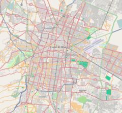
Iztapalapa is a station along Line 8 of the metro of Mexico City.[2][3] It is located on the Calzada Ermita Iztapalapa (also known as Eje 8 Sur) in the Colonia El Santuario neighborhood of Iztapalapa borough on the southeast side of the city.[2]
The station's logo is a sun, representing the ceremony that is celebrated in Iztapalapa every year of the birth of the new sun.[2][4]
The station was opened 20 July 1994.[5][6] Estación Iztapalapa is also the name of a firefighting station in the borough.[7]
- ^ a b Cite error: The named reference
passnrank22-23was invoked but never defined (see the help page). - ^ a b c "Iztapalapa" (in Spanish). Archived from the original on 8 August 2011. Retrieved 30 July 2011.
- ^ Archambault, Richard. "Iztapalapa » Mexico City Metro System". Retrieved 30 July 2011.
- ^ Martínez, Méndez. "Enrique Cerro de la Estrella, INAH Official Web Page" (in Spanish). INAH. Archived from the original on 15 December 2010. Retrieved 31 July 2011.
- ^ "Transporte" (in Spanish). Delegación Iztapalapa. Archived from the original on 4 October 2011. Retrieved 30 July 2011.
- ^ Monroy, Marco. Schwandl, Robert (ed.). "Opening Dates for Mexico City's Subway". Retrieved 20 August 2011.
- ^ "Heroico Cuerpo de Bomberos del Distrito Federal". Archived from the original on 14 May 2015. Retrieved 30 July 2011.

