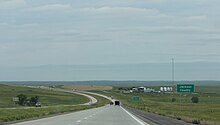
Jackson County | |
|---|---|
 | |
 Location within the U.S. state of South Dakota | |
 South Dakota's location within the U.S. | |
| Coordinates: 43°42′N 101°38′W / 43.7°N 101.64°W | |
| Country | |
| State | |
| Founded | 1883 (created) 1915 (organized) |
| Seat | Kadoka |
| Largest community | Kadoka |
| Area | |
• Total | 1,871 sq mi (4,850 km2) |
| • Land | 1,864 sq mi (4,830 km2) |
| • Water | 7.4 sq mi (19 km2) 0.4% |
| Population (2020) | |
• Total | 2,806 |
• Estimate (2023) | 2,776 |
| • Density | 1.5/sq mi (0.58/km2) |
| Time zone | UTC−7 (Mountain) |
| • Summer (DST) | UTC−6 (MDT) |
| Congressional district | At-large |
| Washabaugh County was merged into Jackson County in 1983 | |


Jackson County is a county in the U.S. state of South Dakota. As of the 2020 census, the population was 2,806.[1] Its county seat is Kadoka.[2] The county was created in 1883, and was organized in 1915.[3] Washabaugh County was merged into Jackson County in 1983.[4]
- ^ "State & County QuickFacts". United States Census Bureau. Retrieved March 21, 2024.
- ^ "Find a County". National Association of Counties. Archived from the original on May 31, 2011. Retrieved June 7, 2011.
- ^ "Dakota Territory, South Dakota, and North Dakota: Individual County Chronologies". Dakota Territory Atlas of Historical County Boundaries. The Newberry Library. 2006. Archived from the original on April 2, 2018. Retrieved March 30, 2015.
- ^ John H. Long, ed. (2006). "Dakota Territory, South Dakota, and North Dakota: Individual County Chronologies". Dakota Territory Atlas of Historical County Boundaries. Newberry Library. Archived from the original on November 13, 2007. Retrieved July 18, 2008.