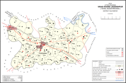
Jagdishpur
Jagdīspur | |
|---|---|
Town | |
 Map showing Jagdishpur CD block | |
| Coordinates: 26°27′23″N 81°37′08″E / 26.456357°N 81.618961°E[1] | |
| Country | |
| State | Uttar Pradesh |
| Division | Faizabad |
| District | Amethi |
| Elevation | 70 m (230 ft) |
| Languages | |
| • Official | Hindi, Urdu |
| Time zone | UTC+5:30 (IST) |
| Website | www.upgov.in |
Jagdishpur is a town,[2] community development block,[3] and former pargana in Musafirkhana tehsil of Amethi district, Uttar Pradesh, India.[3][2] It is also called Nihalgarh, Chak Jangla, or Nihalgarh-Jagdispur.[2] The distinction is that Jagdishpur was the original village, Chak Jangla was an outlying hamlet of Jagdishpur, and Nihalgarh was a fort built in Chak Jangla in the early 1700s and that no longer exists.[2] The town is located at the crossroads between the Lucknow-Jaunpur and Raebareli-Faizabad highways.[2]
- ^ "Geonames Search". Do a radial search using these coordinates here.
- ^ a b c d e Nevill, H.R. (1903). Sultanpur: A Gazetteer, Being Volume XLVI Of The District Gazetteers Of The United Provinces Of Agra And Oudh. Allahabad: Government Press. pp. 183–6. Retrieved 13 November 2021.
- ^ a b "Census of India 2011: Uttar Pradesh District Census Handbook - Sultanpur, Part A (Village and Town Directory)" (PDF). Census 2011 India. pp. 94–111. Retrieved 13 November 2021.
