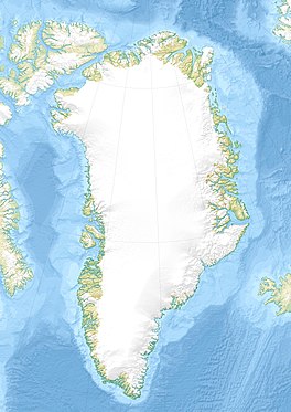
| Jakobshavn Glacier | |
|---|---|
| Jakobshavn Isbræ (Danish) Sermeq Kujalleq (Greenlandic) | |
 The calving front of the glacier | |
| Type | Ice stream |
| Location | Near Ilulissat, Greenland |
| Coordinates | 69°10′N 49°50′W / 69.167°N 49.833°W |
| Area | 110 000 km2 (whole catchment)[1] |
| Length | greater than 65 km[2] |
| Thickness | around 2000 m[2] |
| Terminus | Ocean (was floating now grounded)[3] |
| Status | Advancing [4] |
| Official name | Ilulissat Icefjord |
| Type | Natural |
| Criteria | vii, viii |
| Designated | 2004 |
| Reference no. | 1149 |
Jakobshavn Glacier (Danish: Jakobshavn Isbræ), also known as Ilulissat Glacier (Greenlandic: Sermeq Kujalleq), is a large outlet glacier in West Greenland. It is located near the Greenlandic town of Ilulissat (colonial name in Danish: Jakobshavn) and ends at the sea in the Ilulissat Icefjord.
Jakobshavn Glacier drains 6.5% of the Greenland ice sheet[1] and produces around 10% of all Greenland icebergs. Some 35 billion tonnes of icebergs calve off and pass out of the fjord every year. Icebergs breaking from the glacier are often so large (up to 1 km in height) that they are too tall to float down the fjord and lie stuck on the bottom of its shallower areas, sometimes for years, until they are broken up by the force of the glacier and icebergs further up the fjord.
Studied for over 250 years, the Jakobshavn Glacier has helped develop modern understanding of climate change and icecap glaciology.[5][6] Jakobshavn is one of the fastest-declining glaciers in the world, and icebergs calving from Jakobshavn were responsible for 4 percent of the increase in global sea level in the 20th century.[7] Ilulissat Icefjord (Greenlandic: Ilulissat Kangerlua) was declared a UNESCO World Heritage Site in 2004, in part because of the importance of the Jakobshavn Glacier in contributing to the current scientific understanding of climate change.[8]
- ^ a b Joughin I.; Abdalati W.; Fahnestock M. (2004). "Large fluctuations in speed on Greenland's Jakobshavn Isbrae glacier". Nature. 432 (7017): 608–610. Bibcode:2004Natur.432..608J. doi:10.1038/nature03130. PMID 15577906. S2CID 4406447.
- ^ a b "Plummer Jakobshavn". University of Kansas. Archived from the original on 27 June 2010. Retrieved 17 February 2009.
- ^ Amundsen, J.M., Truffer M., Luthi M.P., Fahnestock M., West M., Motyka R.J. (2008). "Glacier, fjord, and seismic response to recent large calving events, Jakobshavn Isbrae, Greenland". Geophys. Res. Lett. 35 (22): L22501. Bibcode:2008GeoRL..3522501A. doi:10.1029/2008GL035281. hdl:11122/11043. S2CID 45472361. Archived from the original on 6 June 2011. Retrieved 17 February 2009.
{{cite journal}}: CS1 maint: multiple names: authors list (link) - ^ "Why a Growing Greenland Glacier Doesn't Mean Good News for Global Warming". NASA. Retrieved 4 July 2024.
- ^ Bennike, Ole; Naja Mikkelsen; Henrick Klinge Pedersen; Anker Weidick (2004). Ilulissat Icefjord. Geological Survey of Denmark and Greenland. ISBN 978-87-7871-136-6. Archived from the original on 13 February 2012. Retrieved 15 March 2006.
- ^ Weidick, Anker; Naja Mikkelsen; Christopher Mayer; Steffen Podlech (2003). Jakobshavn Isbræ,West Greenland: the 2002-2003 collapse and nomination for the UNESCO World Heritage List. In: Review of Survey activities 2003. Geological Survey of Denmark and Greenland. pp. 85–88. Archived from the original on 31 October 2005. Retrieved 1 March 2006.
- ^ Gertner, Jon (6 January 2024). "Can $500 Million Save This Glacier?". The New York Times. Archived from the original on 7 January 2024. Retrieved 7 January 2024.
- ^ "Ilulissat Icefjord". UNESCO World Heritage Centre. United Nations Educational, Scientific, and Cultural Organization. Retrieved 19 June 2021.
