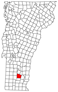
Jamaica, Vermont | |
|---|---|
 Town Hall | |
 Jamaica, Vermont | |
| Coordinates: 43°6′11″N 72°47′33″W / 43.10306°N 72.79250°W | |
| Country | United States |
| State | Vermont |
| County | Windham |
| Chartered | 1780 |
| Settled | 1780 |
| Organized | 1781 |
| Communities |
|
| Area | |
• Total | 49.5 sq mi (128.1 km2) |
| • Land | 49.3 sq mi (127.8 km2) |
| • Water | 0.1 sq mi (0.3 km2) |
| Elevation | 1,135 ft (346 m) |
| Population (2020) | |
• Total | 1,005 |
| • Density | 20/sq mi (7.9/km2) |
| Time zone | UTC-5 (Eastern (EST)) |
| • Summer (DST) | UTC-4 (EDT) |
| ZIP code | 05343 |
| Area code | 802 |
| FIPS code | 50-36175[1] |
| GNIS feature ID | 1462126[2] |
Jamaica is a town in Windham County, Vermont, United States. The population was 1,005 at the 2020 census.[3] The town includes the villages of Jamaica, East Jamaica and Rawsonville.
Its ZIP code is 05343. The town is home to Jamaica State Park, noted for scenic camping spots and various swimming holes, including Hamilton Falls. The nearest large town is Brattleboro.
- ^ "U.S. Census website". United States Census Bureau. Retrieved January 31, 2008.
- ^ "US Board on Geographic Names". United States Geological Survey. October 25, 2007. Retrieved January 31, 2008.
- ^ "Census - Geography Profile: Jamaica town, Windham County, Vermont". Retrieved December 31, 2021.
