| Disputed reef | |
|---|---|
| Other names | Beting Tugau 八仙暗沙 Beting Serupai Zēngmǔ Ànshā (曾母暗沙) |
| Geography | |
| Location | South China Sea |
| Coordinates | 03°58′26″N 112°20′56″E / 3.97389°N 112.34889°E |
| Total islands | 0[1] |
| Administration | |
| State | Sarawak |
| Claimed by | |
| Prefecture-level city Province | Sansha[3] Hainan |
| State | Sarawak |
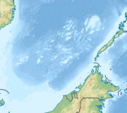
James Shoal[1][6] is a shoal (bank) in the South China Sea, with a depth of 22 metres (72 ft) below the surface of the sea,[1][7] located about 45 nautical miles (83 km; 52 mi) off the Borneo coast of Malaysia. It is claimed by Malaysia, the People's Republic of China, and the Republic of China (Taiwan). The reef and its surrounds are administered by Malaysia.
- ^ a b c Michael Pompeo (13 July 2020). "U.S. Position on Maritime Claims in the South China Sea". State Department. Retrieved 22 July 2020.
- ^ a b Cite error: The named reference
RSISwas invoked but never defined (see the help page). - ^ "Announcement by the PRC Ministry of Civil Affairs regarding State Council's establishment of Sansha City (民政部关于国务院批准设立地级三沙市的公告-中华人民共和国民政部)". Archived from the original on June 25, 2012.
- ^ "Peace in the South China Sea, National Territory Secure Forever Position Paper on ROC South China Sea Policy" (PDF). Ministry of Foreign Affairs (Taiwan). p. 14.
Zengmu Shoal in the south
- ^ Lung Tsun-Ni 龍村倪 (1998). 東沙群島-東沙島紀事集錦 (in Chinese (Taiwan)). Taipei: 臺灣綜合研究院. p. 6. ISBN 957-98189-0-8.
南海諸島圖{...}中華民國{...}曾母暗沙{...}《中華民國全圖》內政部/台北/民87.3.1998
(Note: In the map on this page, James Shoal is shown within what appears to be a close variant of the Nine-dash line or a similar dashed line. The area inside the dashed line is labeled 'Republic of China'.) - ^ "SOUTH CHINA SEA: UP FOR GRABS" (PDF). Bureau of Intelligence and Research. 14 September 1971. p. 5. Archived from the original (PDF) on 23 January 2017.
2) James Shoal (Tseng-mu An-sha) 4°N., 112°15'E., marks the southern extent;
- ^ "Sector 11 - Borneo Northwest Coast" (PDF). Sailing Directions pub. 163. US NGA. p. 305.
Parsons Shoal (Beting Tugau) (3˚54'N., 112˚15'E.), with a depth of 20m, lies 12.32 miles ENE of Lydie Shoal. James Shoal (Beting Serupai), Beting Serupai, with a depth of 22m, lies 15 miles NE of the same shoal. During the Northeast Monsoon (October to March), a distinct line of tide rips may be seen in the vicinity, particularly W of these shoals. Beting Tugau is marked by Beting Tugau Lighted Buoy. A shoal, with two heads having depths of 21m and 22m, lies 13 miles SSE of Parsons Shoal.
