This article needs additional citations for verification. (May 2008) |
Jamtara district | |
|---|---|
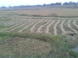
 Field in Jamtara district | |
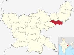
 Location of Jamtara district in Jharkhand | |
| Coordinates (Jamtara): 23°57′36″N 86°48′00″E / 23.96000°N 86.80000°E | |
| Country | |
| State | |
| Division | Santal Pargana |
| Headquarters | Jamtara |
| Government | |
| • Lok Sabha constituencies | 1. Dumka (shared with Dumka district) |
| • Vidhan Sabha constituencies | 3 |
| Area | |
| • Total | 1,801.98 km2 (695.75 sq mi) |
| Population (2011) | |
| • Total | 791,042 |
| • Density | 440/km2 (1,100/sq mi) |
| Demographics | |
| • Literacy | 64.59% |
| • Sex ratio | 959 |
| Time zone | UTC+05:30 (IST) |
| Website | jamtara |
Jamtara district is one of the twenty-four districts of Jharkhand state in eastern India. Jamtara town is the administrative headquarters of this district. The district is situated between 23°10′ and 24°05′ north latitudes and 86°30′ and 87°15′ east longitudes.