Jaynagar Majilpur | |
|---|---|
|
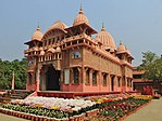
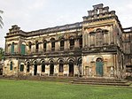
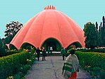
Clockwise from top: Jaynagar Majilpur Municipality, Ramkrishna Ashram, Indira Gandhi Community Hall, Jaynagar Majilpur Railway Station, Dutta Bari, Sarada Ashram | |
 Interactive Map Outlining Jaynagar Majilpur | |
| Coordinates: 22°10′31″N 88°25′12″E / 22.1751965°N 88.4200762°E | |
| Country | |
| State | |
| Division | Presidency |
| District | South 24 Parganas |
| Region | Greater Kolkata |
| Government | |
| • Type | Municipality |
| • Body | Jaynagar Majilpur Municipality |
| Area | |
| • Total | 5.85 km2 (2.26 sq mi) |
| Elevation | 8 m (26 ft) |
| Population (2011) | |
| • Total | 25,922 |
| • Density | 4,400/km2 (11,000/sq mi) |
| Languages | |
| • Official | Bengali[1][2] |
| • Additional official | English[1] |
| Time zone | UTC+5:30 (IST) |
| PIN | 743337 |
| Telephone code | +91 3218 |
| Vehicle registration | WB-19 to WB-22, WB-95 to WB-99 |
| Lok Sabha constituency | Jaynagar (SC) |
| Vidhan Sabha constituency | Jaynagar (SC) |
| Website | www |
Jaynagar Majilpur (Bengali: [d͡ʒɔe̯nɔgoɾ mod͡ʒɪlpuɾ] ) is a town and a municipality of the South 24 Parganas district in the Indian state of West Bengal. It is situated in the southern suburbs of Kolkata. As an urban setup in the vicinity of Kolkata, the town is within the area of Greater Kolkata. It is a part of the area covered by the Kolkata Metropolitan Development Authority (KMDA).[3] Jaynagar and Majilpur are two separate towns. Since the formation of the municipality, these twin towns are known together as Jaynagar Majilpur. The town is famous for its confectionery called Jaynagarer Moa.[4]
- ^ a b "Fact and Figures". Wb.gov.in. Retrieved 5 July 2019.
- ^ "52nd Report of the Commissioner for Linguistic Minorities in India" (PDF). Nclm.nic.in. Ministry of Minority Affairs. p. 85. Archived from the original (PDF) on 25 May 2017. Retrieved 5 July 2019.
- ^ "Base Map of Kolkata Metropolitan Area". Kolkata Metropolitan Development Authority. Archived from the original on 28 September 2007. Retrieved 3 September 2007.
- ^ "Special packaging for Jaynagarer Moa ?". The Times of India. 1 February 2016. Retrieved 3 February 2016.

