Jennings, Michigan | |
|---|---|
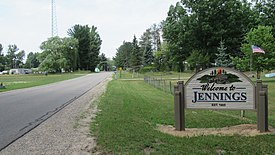
 Welcome sign along S. La Chance Road | |
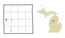
 Location within Missaukee County and the state of Michigan | |
| Coordinates: 44°19′58″N 85°17′53″W / 44.33278°N 85.29806°W | |
| Country | United States |
| State | Michigan |
| County | Missaukee |
| Townships | Lake and Caldwell |
| Established | 1885 |
| Area | |
| • Total | 0.76 sq mi (1.97 km2) |
| • Land | 0.76 sq mi (1.97 km2) |
| • Water | 0.00 sq mi (0.00 km2) |
| Elevation | 1,306 ft (398 m) |
| Population | |
| • Total | 229 |
| • Density | 301.71/sq mi (116.54/km2) |
| Time zone | UTC-5 (Eastern (EST)) |
| • Summer (DST) | UTC-4 (EDT) |
| ZIP Code | 49651 (Lake City) |
| Area code | 231 |
| GNIS feature ID | 629259[3] |
| FIPS Code | 26-41720 |
Jennings is an unincorporated community and census-designated place (CDP) in Missaukee County in the U.S. state of Michigan. The population was 229 at the 2020 census,[2] down from 264 in 2010.[4] The CDP is located mostly in Lake Township with a small portion extending north into Caldwell Township.
- ^ "2023 U.S. Gazetteer Files: Michigan". United States Census Bureau. Retrieved October 23, 2023.
- ^ a b "P1. Race – Jennings CDP, Michigan: 2020 DEC Redistricting Data (PL 94-171)". U.S. Census Bureau. Retrieved October 23, 2023.
- ^ "Jennings". Geographic Names Information System. United States Geological Survey, United States Department of the Interior.
- ^ "2010 Census Gazetteer Files - Places: Michigan". U.S. Census Bureau. Retrieved May 6, 2018.

