This article includes a list of general references, but it lacks sufficient corresponding inline citations. (May 2024) |
| Jericho Trail | |
|---|---|
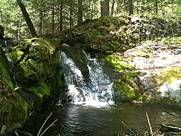
 Jericho Brook water falls over ancient broken dam into pool below. | |
| Length | 3.4 miles (5.5 km)[1] |
| Location | Mattatuck State Forest, Watertown (near Thomaston and Plymouth), Litchfield County, Connecticut |
| Designation | CFPA Blue-Blazed Trail |
| Use | hiking, cross-country skiing, snowshoeing, fishing, rock climbing, geocaching |
| Highest point | Crane's Lookout, 810 ft (250 m) |
| Difficulty | Easy to moderate difficulty, some rock scrambling. |
| Sights | Naugatuck River Valley, White stone cliffs, Rock House, Crane's Lookout. |
| Hazards | hunters, deer ticks, poison ivy |
The Jericho trail is a 3.4-mile (5.5 km) Blue-Blazed hiking trail in Watertown, near the border with Thomaston and Plymouth, Litchfield County, Connecticut. The trail is contained almost entirely in a section of the Mattatuck State Forest. The mainline trail is a linear north–south "hike-through" trail.
The trail is listed as one of the three short Waterbury Area Trails in the Connecticut Walk Book West.
The Jericho trail is a linear trail with a trailhead and parking area at the trails southern terminus on Echo Lake Road and a connector trail leading to Connecticut Route 262 in the west. The northern terminus terminates at the trail's intersection with the Mattatuck Trail near the Rock House and Crane's Lookout. Notable features several scenic overlook views including an 810-foot summit with a 270 degree panorama (Crane's Lookout 41°37′45″N 73°03′23″W / 41.6293°N 73.0565°W). The trail stops just before Crane's Lookout and the Rock House underneath, both which are on the Mattatuck Trail.[2] The trail is maintained largely through the efforts of the Connecticut Forest and Park Association.
- ^ Colson, Ann T. (2006). Connecticut Walk Book West (19th ed.). Connecticut Forest and Park Association. ISBN 0-9619052-6-3.
- ^ Connecticut Walk Book: A Trail Guide to the Connecticut Outdoors. 17th Edition. The Connecticut Forest and Park Association. Rockfall, Connecticut. Undated.