Jhalokati
ঝালকাঠি | |
|---|---|
|
From top: Jhalokati Sadar Road, Kirtipasha Zamindar Bari Ruins and Jhalokathi N S Kamil Madrasah Complex | |
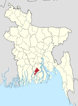
 Location of Jhalokati in Bangladesh | |
 Expandable map of Jhalokati District | |
| Coordinates: 22°34′N 90°09′E / 22.567°N 90.150°E | |
| Country | |
| Division | Barisal |
| Headquarters | Jhalokati |
| Government | |
| • Deputy Commissioner | Md. Johar Ali |
| Area | |
• Total | 706.76 km2 (272.88 sq mi) |
| Population | |
• Total | 661,160 |
| • Density | 940/km2 (2,400/sq mi) |
| Time zone | UTC+06:00 (BST) |
| Postal code | 8400 |
| Area code | 0498 |
| ISO 3166 code | BD-25 |
| HDI (2018) | 0.672[2] medium · 2nd of 21 |
| Website | www |
Jhalokati, also spelled Jhalokathi, (Bengali: ঝালকাঠি) is a district in southern Bangladesh.[3] It is located in the Barisal Division and covers an area of 758.06 km2 It is bounded by Barisal district to the north, Barguna district to the east and the Bishkhali river in the south, and Pirojpur district to the west. The main rivers in this district are the Bishkhali, Dhanshiri, Gabkhan, Sugandha, Jangalia, Bamanda and Bajitpur. "পেয়ারা আর শীতলপাটি, এই নিয়ে ঝালকাঠি" "(Jhalokathi, The land of tasty Guava and Shitolpati)" is the official motto of the district.[4]
- ^ Cite error: The named reference
2022censuswas invoked but never defined (see the help page). - ^ "Sub-national HDI - Area Database - Global Data Lab". hdi.globaldatalab.org. Retrieved 18 March 2020.
- ^ a b Rahman, Humayun (2012). "Jhalokati District". In Islam, Sirajul; Jamal, Ahmed A. (eds.). Banglapedia: National Encyclopedia of Bangladesh (Second ed.). Asiatic Society of Bangladesh.
- ^ ছবিতে জেলা ব্র্যান্ডিং [District Branding]. Jhalokati District (in Bengali).


